 | ||
| NASA Press Briefing at the LPSC 2013. Yes, I am in this picture somewhere. Image credit: Lunar and Planetary Institute. |
Well, Lunar and Planetary Science Conference (LPSC) was an exciting whirlwind this year. I had every intention of writing several blogs during the conference, but that just didn't happen. The main reason is that I was overwhelmed by microblogging.
What is microblogging you ask? Well, for the first time this year, the LPSC organizers recruited a bunch of conference attendees to write short blurbs about the session talks, in order to get the research out to the community. Most people tweeted, or posted on facebook, but I chose to focus on Google+.
I have a small, but growing following of interested people on Google+, who represent the general public, not planetary scientists. I wanted to share with them the exciting research that was being presented at LPSC. So, my challenge was to synthesize highly compact and technical talks into something that intelligent lay people could understand.
Surprisingly, this turned out to be far more difficult than I had anticipated. The problem was that I had not taken into account how interesting all of the talks would be, and so I found myself trying to compose paragraphs on one talk while trying to listen to another talk. It was extremely draining! What I eventually ended up doing was taking meticulous notes, and then blogging at lunch or dinner time about the talks I found most interesting. A great solution, but it left me with no time for anything else.
Regardless, I am very pleased with the microblogs that I put out. So, I was quite disappointed to find out that people who aren't Google+ subscribers can't see my posts. I had, after all, purposefully made them public.
As a result, I have decided to reproduce my entire complement of LPSC microblogs here on my Planetary Geo Log. It's a long list, so don't feel the need to digest it all at once, but rather come back every once in a while to savour a few small nuggets at a time. I will be writing up some of the most interesting (to me, anyway) talks in more detail in future blogs. If you see anything below that you would like me to write up, please do not hesitate to ask. And now, here are my impressions of the LPSC as it happened.
Sunday March 17, 2013
1) LPSC is starting tomorrow and I will be microblogging about the exciting science that I hear.
Meanwhile, today at Microsymposium 54, Lionel Wilson says that large lunar lavas flows must have been emplaced in a turbulent fashion. I am enjoying the thought of standing on the Moon 3.8 billion years ago and watching a roiling torrent of magma rushing by...
2) Met a bunch of fellow microbloggers at the #LPSC2013 Tweetup tonight. Am humbled to be in such fine company.
Monday March 18, 2013
1) Katelyn Lehman suggests that bright iron-poor regions in the Marius Hills region of the Moon were formed when magma evolved and separated into layers below the lunar surface. The iron-poor component of the magma would then have extruded to the surface at some point.
My question is how do you get a stable body of magma to sit below the surface for long enough to stratify into layers? Walter Kiefer says he'll tell me later, based on his latest gravity models. Stay tuned.... (http://www.lpi.usra.edu/meetings/lpsc2013/pdf/1225.pdf)
2) B.Ray Hawke just coughed during a key point in a talk. Still trying to figure out if he disagrees with the science, or really just needed to cough.
3) Lisa Gaddis tells us that pyroclastic glass beads, which were fountained out of volcanic vents inside Oppenheimer crater on the far side of the Moon, contain high-calcium pyroxene minerals. The problem is that high-calcium pyroxene minerals + glass look like olivine minerals in spectral data. This means that previous identification of olivine minerals based on spectral data could be wrong. Olivine minerals on the Moon tend to be related to the lower crust. So, getting that wrong means we may not be understanding where large impacts are excavating lower crustal material and where they aren't.
(http://www.lpi.usra.edu/meetings/lpsc2013/pdf/2262.pdf)
4) Golden Spike meeting at #LPSC2013. Alan Stern is telling us about his company that is dedicated to developing a commercial human transportation system to the Moon. He asserts that companies and nations will sign up for a berth, because everyone wants to be able to say they have "joined the club."
5) If you are enjoying my Google+ updates from #LPSC2013, I invite you to follow Goetz Galuba, who is also microblogging from the conference, but on different sessions.
(https://plus.google.com/u/0/108630442597576886778/posts)
6) Haase is using Apollo 17 Hasselblad photographs, collected by the astronauts, to better pinpoint the locations where the Apollo 17 seismic experiment components were deployed. Her new positions find that 1 geophone is 9 meters away from where previous work put it. This kind of fiddly position information is important, because the locations of the geophones, which collect the seismic information, affect the model of the lunar subsurface and interior that is generated.
(http://www.lpi.usra.edu/meetings/lpsc2013/pdf/1966.pdf)
7) #LPSC2013 Students and Scientists Reception tonight had an ice cream sunday buffet!
8) Checked the #LPSC2013 Twitter feed before heading back to my hotel. Found out that people were gathering at the local bar to play a geeky version of Cards Against Humanity. Will have to go join them.
Tuesday March 19, 2013
1) Have not been able to attend any of the morning sessions at #LPSC2013 so far this morning. Have been far too busy interacting with people and pursuing job opportunities. Science conferences are about so much more than just the science!
2) This morning at #LPSC2013, Chip Shearer showed that plagioclase and pyroxene mineral grains in lunar rock sample 60016 appear to have exchanged element atoms at sub-solidus (colder than melting) temperatures. This is a concern, because these elements, especially samarium (Sm) and neodymium (Nd), are used to date lunar samples. If they can migrate between minerals, without leaving markers (like melting) that show the elements were free to move, our estimates of lunar ages based on such samples may be suspect.
(http://www.lpi.usra.edu/meetings/lpsc2013/pdf/1689.pdf)
3) Maria Zuber and Mark Wieczorek's talks at #LPSC2013 explain how gravity data from the GRAIL mission is showing that the crust of the Moon is more homogeneous (well mixed), less dense (fluffier), and thinner than has been previously thought.
(http://www.lpi.usra.edu/meetings/lpsc2013/pdf/1777.pdf)
(http://www.lpi.usra.edu/meetings/lpsc2013/pdf/1914.pdf)
4) Michael Sori just gave an excellent talk explaining how he is using GRAIL gravity data to search for cryptomare, hidden extruded magma deposits, on the Moon. His work found several previously unidentified cryptomare deposits.
(http://www.lpi.usra.edu/meetings/lpsc2013/pdf/2755.pdf)
5) Greg Neumann used GRAIL gravity and LOLA topography data to find a number of new impact basins on the Moon. Sadly, Greg still feels that the data idoes NOT conclusive identify a large Procellarum impact structure, which that predates South Pole Aitken basin.
(http://www.lpi.usra.edu/meetings/lpsc2013/pdf/2379.pdf)
6) Scientists have known since before the Apollo era that large impact basins on the Moon exhibit mass concentrations, called mascons, in gravity data. Today at #LPSC2013, Andrew Freed explains how new modelling shows that the bulls-eye gravity pattern that is associated with mascons, is actually a natural consequence of the basin-forming, collapse, and cooling process that all basins undergo.
(http://www.lpi.usra.edu/meetings/lpsc2013/pdf/2037.pdf)
7) The Moon was warmer on the nearside when the large basins were formed. Katarina Miljkovic calculates that impacts forming at this time on the lunar near side would have created basins that are 2 times as large as those that would have been formed by the same impactors on the far side. This means that our inventory of large basins on the Moon is misrepresentative and our understanding of lunar chronology from impacts may be wrong. #LPSC2013
(http://www.lpi.usra.edu/meetings/lpsc2013/pdf/1926.pdf)
8) Quick dinner at #LPSC2013 then off to poster sessions.
Wednesday March 20, 2013
1) Aileen Yingst's #LPSC2013 poster last night showed that sphere-shaped features at the Rocknest site in Gale crater on Mars were most-likely impact glass spherules formed when a large meteorite struck the surface, spraying out droplets of melt.
(http://www.lpi.usra.edu/meetings/lpsc2013/pdf/1257.pdf)
2) Also at the #LPSC2013 poster session last night, M. Sharp analyzed highly siderophile elements in lunar impact melt samples to see if she could identify the meteorite types that were responsible for making these melts. Not only was she successful, but she also found that in several cases, more than one meteorite was responsible. So, first one impactor hit the Moon's surface, then the resulting impact melt was hit by a second impactor, forming new melt that retained the signature from both impactors.
(http://www.lpi.usra.edu/meetings/lpsc2013/pdf/1280.pdf)
3) I had a spectacularly productive discussion with Jenny Whitten at the #LPSC2013 poster session last night. She is using M3 data to look for hidden mare (cryptomare) deposits on the Moon. Her work has found that many craters in cryptomare areas show obvious iron signatures, from the hidden basalts, but don't necessarily have halos of dark basalt material surrounding the craters. My work, which I will present in a poster on Thursday night, shows similar results using other data. So, we talked about collaborating and publishing our results together.
Some of the best collaborations are formed this way, while talking to colleagues at a conference!
(http://www.lpi.usra.edu/meetings/lpsc2013/pdf/1247.pdf)
(http://www.lpi.usra.edu/meetings/lpsc2013/pdf/2607.pdf)
4) P. Isaacson has compared satellite data of the Moon with lab data of a meteorite from the Moon that was found on Earth. His analysis was able to determine that this meteorite most likely came from the north-western highlands on the far side of the Moon.
(http://www.lpi.usra.edu/meetings/lpsc2013/pdf/1134)
5) A few years ago, Carle Pieters presented M3 hyperspectral data that showed evidence of a pink spinel mineral at certain locations on the Moon. The problem is that pink spinel has not been seen in any of the returned lunar samples, so information on how this unique mineral would have formed on the Moon has been very sparse. Today at #LPSC2013, T. Pressel and a team of researchers from Brown University told us that pink spinel is formed when certain types of volcanic lavas mix with the mineral plagioclase. The Moon's crust is made up almost exclusively of plagioclase. So, it appears that the pink spinels Carle found were formed when hot, liquid magma travelled through the lunar crust, melting and incorporating some of the plagioclase minerals, allowing spinel minerals to form when the magma cooled.
(http://www.lpi.usra.edu/meetings/lpsc2013/pdf/3066)
6) Building on the discussion of pink spinels, Satoru Yamamoto noted that an impact into a target containing both Mg-suite rocks and plagioclase crust would melt both these materials and also create the conditions necessary to form pink spinels. He pointed out that all currently known occurrences of pink spinels are associated with impact basins. Therefore, he favours an impact process, not a volcanic process, for their formation.
(http://www.lpi.usra.edu/meetings/lpsc2013/pdf/1768)
7) And even more on pink spinels from #LPSC2013. Ying Sun mapped all the places on the Moon where pink spinels are found in the central peaks of craters. Using formulas that relate the diameter of a crater to the excavation depth of its central peak, she was able to calculate the depth these pink spinels came from for each central peak. Ying's data shows that these spinels have been excavated from depths ranging from 5-25 km. These numbers are not quite consistent with the model proposed by Pressel and his co-workers. Clearly there is a lot that we still don't understand.
(http://www.lpi.usra.edu/meetings/lpsc2013/pdf/1393)
8) No community discussion at the LEAG town hall at #LPSC2013 this year.
9) My #LPSC2013 poster is now up. If you are at the conference, stop by and see why it took me 45 minutes to put it up.
(http://www.lpi.usra.edu/meetings/lpsc2013/eposter/2607.pdf)
10) This afternoon at #LPSC2013, I scheduled a bunch of meetings. Nothing in the sessions particularly calls to me, so it's time to work on some collaborations.
11) Take advantage of your university alumni networks to help you find non-traditional work that will let you do what you enjoy doing in the field of science says Emily Lakdawalla at the #LPSC2013 Women in Planetary Science Network Event.
12) Tonight, my dinner group included Rene DeHon, who estimated the thickness of mare basalt deposits on the Moon back in 1979. I was honoured to meet such an icon in my field. He in turn was thrilled to hear that people like me were still using his data. I love the way scientists think!
Thursday March 21, 2013
1) I am ashamed to admit that today I drove somewhere so I could go for a run. The area around my hotel is just too industrial to be safe for running. I know - I tested it on Tuesday.
2) More evidence of impact melt sheet differentiation at #LPSC2013. A. Whittman has determined that lunar meteorite Shisr 161 probably came from an impact melt sheet in the centre of a large basin. This melt sheet would have been thick enough to allow minerals of different densities to float or sink in the melt when crystallizing. Meteorite Shisr 161 shows chemical and mineral compositions that are consistent with what the top of this melt sheet, where the less dense minerals accumulated, would look like.
(http://www.lpi.usra.edu/meetings/lpsc2013/pdf/2061)
3) Jay Melosh just took someone to task at #LPSC2013 for presenting a bunch of numerical models with little relation to observational data, and that when the models were finally compared to observational data, the agreement was fairly poor. Wow! Peer review in real time!
4) After an impact event, the area under the resulting crater is very fractured. This afternoon at #LPSC2013, C. Elder told us that on icy planets, water melted by the impact can easily drain through these fractures. But, on rocky planets, magma melted by the impact has a very difficult time draining through such fractures, and so will pool and solidify on the surface.
(http://www.lpi.usra.edu/meetings/lpsc2013/pdf/2796)
5) More controversy in the #LPSC2013 impact session this afternoon. Buck Sharpton stated that his observations of high resolution image data from the Moon (Lunar Reconnaissance Orbiter Narrow Angle Camera data), show that some impact ejecta appears to be *injected* into the crater walls rather than emplaced on top of the crater rim. Several people, including Jay Melosh and Boris Ivanov, thought it was more likely that Buck was seeing deformation rather than injection. But, Buck was firm that he saw no evidence of deformation of the crater wall rocks associated with the injected ejecta. This is how science works!
(http://www.lpi.usra.edu/meetings/lpsc2013/pdf/2789)
 |
|
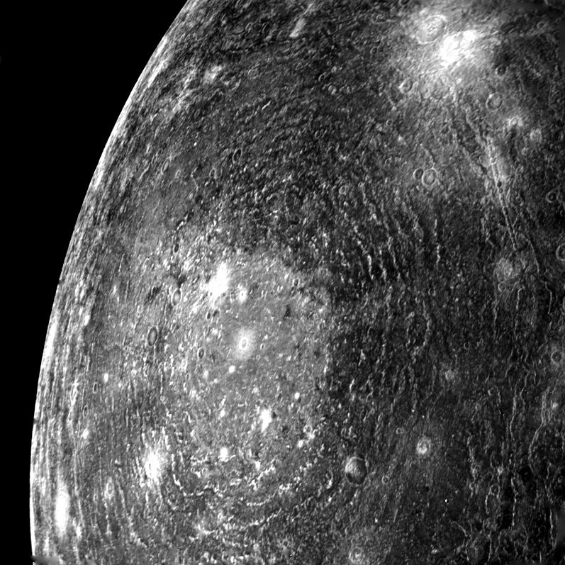
Valhalla basin on Callisto
Image credit: NASA/JPL |
(http://www.lpi.usra.edu/meetings/lpsc2013/pdf/1302)
7) M. Bierhaus modelled the effects of large impact on the interior of Mars, finding that high energy impacts can affect the temperature of the martian mantle, which would reduce the thickness of the crust. However, Jay Melosh pointed out that for large impacts, the ejecta will also be very hot, and that this was not taken into account in this model. Jay Melosh is so knowledgeable when it comes to impacts.
(http://www.lpi.usra.edu/meetings/lpsc2013/pdf/2420)
8) In the last talk of the day at #LPSC 2013, S. Stuart told us that Earth had experienced *at least* 2 giant impact events in its early history. These impacts would have been so large that the atmosphere would have been completely lost each time and the temperatures would have been so hot that the entire surface would have melted, forming a magma ocean.
(http://www.lpi.usra.edu/meetings/lpsc2013/pdf/2419)
9) Time for poster sessions at #LPSC2013. I will be presenting two, so I won't get to see many others unfortunately.
10) #LPSC2013 poster session went well. I had two posters at the same time. Luckily, I could see both of them if I stood in a certain spot, so I could keep track of both and address questions for either one if necessary. Now it's time to go dance, but my feet hurt....
By the way, here's a link to one of my posters on-line.
(http://www.lpi.usra.edu/meetings/lpsc2013/eposter/2705.pdf)
Friday March 22, 2013
1) Final day of #LPSC2013. Things are winding down as many people fly out today, but there is still a full day of talks to come.
2) This morning at #LPSC2013, K. Young reported on age dating work conducted on the Mistastin impact structure. Impact melt materials show a date of roughly 35 million years, while rocks from the central peak structure have an age of approximately 1.2 billion years. This is very interesting because 1) Central peaks are formed when material from deep under the crater centre is pushed up to create a set of relatively high hills in the last stages of crater development, and 2) age dating is very sensitive to temperature. So, a 1.2 billion year old age for the central peaks means that the very dynamic peak-forming process must have happened at relatively cool temperatures. I find this surprising!
(http://www.lpi.usra.edu/meetings/lpsc2013/pdf/2426)
3) The shock pressures associated with impacts create some interesting changes in the minerals that don't get melted. Annemarie Pickersgill, in her #LPSC2013 presentation, showed some great pictures of these changes from the Mistastin impact structure in Labrador, Canada. One such change is called "plumose texture," where plume-like regions are seen within the structure of individual crystals. The significance of this plumose texture is that it appears to be a transition phase between the crystal state and melt state of the shocked minerals. In other words, mineral grains that show plumose texture experiences almost enough shock pressure to get melted, but not quite enough.
(http://www.lpi.usra.edu/meetings/lpsc2013/pdf/2471)
4) Arctic cratering expert Gordon Osinski reported a newly identified impact crater in Victoria Island, Canada. The Tunnnik impact structure is a complex crater, 28 km in diameter. It is very eroded, but still exposed at the surface. The most interesting thing about this crater is the numerous shatter cones that are found here. Shatter cones are striated conical features, unique to impacts, which are formed by the sudden applications of very high pressures during the cratering process.
(http://www.lpi.usra.edu/meetings/lpsc2013/pdf/2099)
5) S. Li used M3 multispectral data to find that hydration is related to the optical maturity of the lunar surface. Soils that are exposed on the surface of the Moon undergo a number of processes that alter the way they look, making them more "optically mature". The implication of the correlation between hydration and optical maturity is that "water" may have been implanted on the lunar surface by wind, with surfaces with a longer exposure time having more water.
(http://www.lpi.usra.edu/meetings/lpsc2013/pdf/1337)
6) Mid-afternoon at #LPSC2013. Crowd is getting thinner as people head to the airport, but enough people are still hanging around to make for interesting discussions.
7) A lively exchange was prompted by D. Hurwitz's talk at #LPSC2013 this afternoon, where she presented models for the initial conditions that would be required to produce an impact melt sheet of the kind we think we see in South Pole-Aitken basin. After the talk, Paul Warren got up to point out that Hurwitz's model did not consider how large blocks, which slumped from the crater walls, would affect the melt composition. David Kring, a co-author on this paper, responded that it is assumed very little of these kinds of slump blocks would be melted to contaminate the main melt sheet. To this, Paul responded "That's a whopper of an assumption!"
(http://www.lpi.usra.edu/meetings/lpsc2013/pdf/2224)
8) Catherine Johnson reported on work conducted by her graduate student, showing that impact craters are deeper on the lunar highlands than in the maria. It is thought that this might be caused by the recent findings that the highlands crust of the Moon is "fluffier" or more porous than previously believed.
(http://www.lpi.usra.edu/meetings/lpsc2013/pdf/1309)
9) As craters on the Moon get older, they tend to degrade; their edges get less sharp and they get shallower. C Fassett presented modelling results on this process at the #LPSC2013 this afternoon. His work shows that small craters (~1 km in diameter) get shallower much faster than larger craters (~3 km in diameter). After 3 billion years, craters that are 300 meters in diameter would have a depth that is only 6% of their original depth. Many surfaces on the Moon are older than 3 million years, so it is expected that the oldest small craters on these surfaces would have been erased.
(http://www.lpi.usra.edu/meetings/lpsc2013/pdf/2026)
10) Mike Zanetti used small impact craters to model the age of Aristachus crater ejecta on the Moon. His results show that model ages are not very robust; ages get progressively older as you move outwards from the rim of Aristarchus, and the age around the crater (at the same distance from the rim) is also not consistent from place to place. This suggests there is a very big problem with using craters counts to model ages that needs to be addressed.
(http://www.lpi.usra.edu/meetings/lpsc2013/pdf/1842)
11) Well, we have reached the end of #LPSC2013. I hope you have enjoyed my microblogs. I have really enjoyed posting them, though I confess, I had not anticipated how hard it would be to encapsulate an entire talk in a short paragraph, all while listening to the equally exciting talk right after it. It has been great, though, and I would be willing to do this again next year if people are interested in seeing more of this kind of thing.
In the mean time, keep an eye on my regular blog (http://planetarygeolog.blogspot.com/). I will be writing up some of the LPSC results in more detail there. I had intended to do that during the conference, but there just didn't seem to be enough time.
Thanks to all for following and liking.
12) End of #LPSC2013. I had a really great time and learned a lot. Till next year, when we will do this all again....


